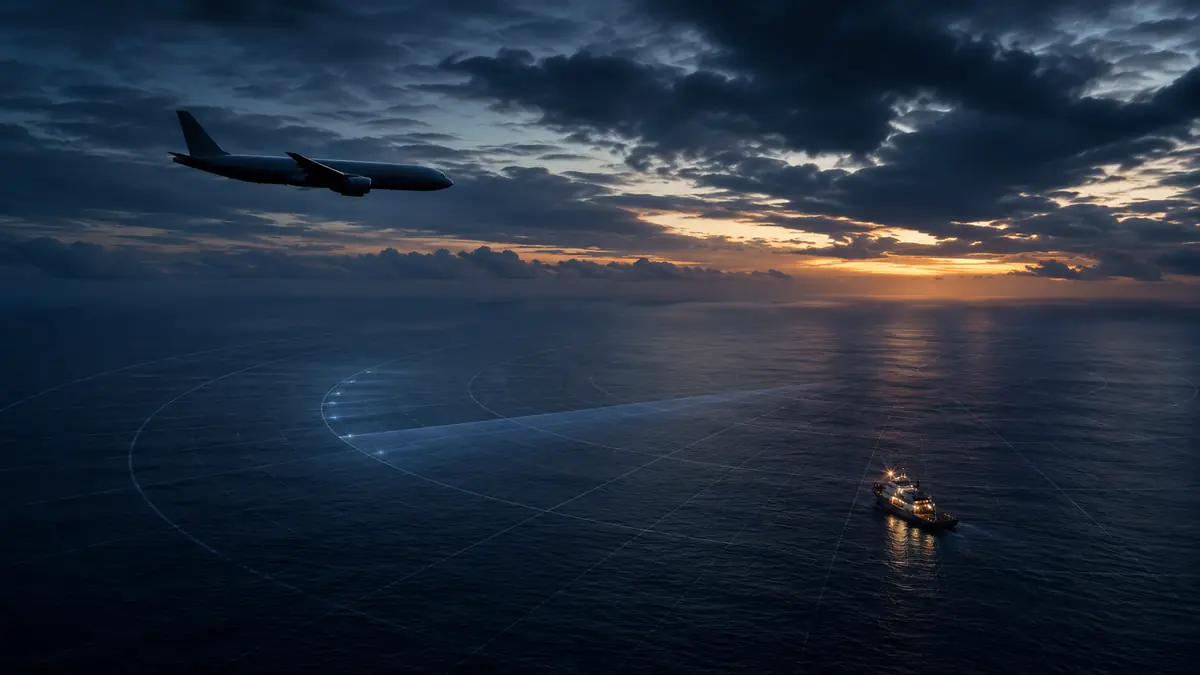
Malaysia Airlines Flight MH370 disappeared with 239 people aboard on March 8, 2014, during a scheduled journey from Kuala Lumpur to Beijing. Although satellite data and recovered debris indicate that the Boeing 777 ended in the southern Indian Ocean, its main wreckage, flight recorders, and exact cause have not been found.
Direct answer: Investigators believe malaysia flight 370 reversed course after its communication systems stopped transmitting, crossed the Malay Peninsula, and flew south over the Indian Ocean for several hours. Confirmed wreckage supports an ocean impact, but without the aircraft’s black boxes and primary debris field, no official investigation has determined why it diverted or who controlled it.
What Was Malaysia Airlines Flight MH370?
MH370 was a scheduled Malaysia Airlines passenger service from Kuala Lumpur International Airport to Beijing Capital International Airport. The aircraft was a Boeing 777-200ER registered as 9M-MRO.
The flight departed shortly after midnight on March 8, 2014, carrying:
| People aboard | Number |
|---|---|
| Passengers | 227 |
| Crew members | 12 |
| Total | 239 |
Most passengers were Chinese citizens, while others came from Malaysia, Australia, Indonesia, India, France, the United States, and several additional countries.
Captain Zaharie Ahmad Shah and First Officer Fariq Abdul Hamid were operating the aircraft. The Boeing 777 had accumulated thousands of flight cycles and was considered a mature, widely used long-range airliner.
Nothing publicly known about the departure suggested an immediate emergency. The weather was suitable, the aircraft climbed normally, and routine radio communication continued during the first stage of the flight.
That normality makes what happened next so difficult to explain.
Malaysia Flight 370 Timeline: How the Plane Disappeared
Understanding the disappearance requires separating verified records from later interpretations.
Departure and final radio transmission
MH370 departed Kuala Lumpur at approximately 12:41 a.m. local time. It climbed toward its assigned cruising altitude of 35,000 feet and followed its planned route northeast across the South China Sea.
At about 1:19 a.m., as responsibility for the flight was being transferred from Malaysian to Vietnamese air traffic control, the cockpit transmitted its final recorded radio message:
“Good night Malaysian Three Seven Zero.”
Approximately two minutes later, the aircraft’s transponder stopped transmitting its identity and altitude to civilian secondary radar.
Its Aircraft Communications Addressing and Reporting System, commonly called ACARS, had also stopped sending routine data. Investigators could not conclusively determine exactly when or why the system ceased normal transmissions.
The unexplained turn west
Instead of continuing toward Beijing, an aircraft later identified through Malaysian military radar as MH370 turned west.
It crossed the Malay Peninsula, passed near Penang, and continued northwest over the Strait of Malacca. Radar tracking eventually ended as the aircraft moved beyond coverage near the northern part of the strait.
This reversal was not a minor navigational deviation. It involved a major departure from the filed flight plan.
The Malaysian safety investigation concluded that the course changes were probably made through manipulation of the aircraft’s controls or navigation system. It did not identify the person responsible or establish a motive.
The satellite handshakes
MH370 had disappeared from conventional radar, but it was not entirely silent.
A satellite communications terminal aboard the aircraft continued exchanging automated signals—known as handshakes—with an Inmarsat satellite. These exchanges did not reveal the aircraft’s precise coordinates, but their timing and signal characteristics allowed analysts to estimate its distance and movement relative to the satellite.
The evidence included:
- Burst Timing Offset, or BTO, data used to calculate possible distance arcs
- Burst Frequency Offset, or BFO, data used to evaluate relative motion
- A series of automated handshakes lasting several hours
- A final partial exchange at approximately 8:19 a.m. Malaysian time
Analysis produced two broad corridors: one extending north across Asia and another extending south into the Indian Ocean. Investigators eliminated the northern corridor using radar, satellite, and other available evidence.
The remaining data indicated that the aircraft flew south until fuel exhaustion became the most likely explanation for its final satellite communications.
Where Is Malaysia Flight 370 Believed to Have Crashed?
The prevailing official assessment places the aircraft in the southern Indian Ocean, west of Australia.
This location was not identified through a conventional distress signal or eyewitness account. It emerged from combining multiple forms of evidence:
- Military and civilian radar records
- Inmarsat satellite communications
- Aircraft performance and fuel-range calculations
- Boeing 777 system behavior
- Ocean-current and debris-drift modelling
- Physical wreckage recovered around the western Indian Ocean
Analysts concentrated heavily on the seventh satellite arc—the possible positions from which the aircraft made its final satellite exchange.
The arc crosses an enormous, remote stretch of ocean. It is not a single point. Search planners therefore had to estimate where along that curved line the aircraft might have descended.
The seabed presents another challenge. Search zones can lie thousands of kilometres from the nearest port and include underwater mountains, ridges, trenches, steep slopes, and depths approaching six kilometres.
The Australian Transport Safety Bureau-led operation searched more than 120,000 square kilometres before its suspension in January 2017. A subsequent Ocean Infinity mission brought the total seabed examined by May 2018 to nearly 200,000 square kilometres without finding the aircraft.
What Debris From MH370 Has Been Found?
Physical debris is the strongest publicly available evidence that MH370 ended in the Indian Ocean.
The Réunion Island flaperon
On July 29, 2015, a wing component washed ashore on Réunion, a French island east of Madagascar. Specialists identified it as a flaperon from a Boeing 777.
Serial-number and maintenance-record analysis connected the component to 9M-MRO. It became the first piece of wreckage officially confirmed as coming from MH370.
A flaperon is a movable control surface on the trailing edge of a wing. It performs functions associated with both flaps and ailerons, helping control lift and roll.
Other recovered pieces
Additional aircraft debris was subsequently recovered from coastlines and islands including:
- Mozambique
- Tanzania
- South Africa
- Madagascar
- Mauritius
- Rodrigues Island
Some objects were confirmed as belonging to MH370, while investigators assessed others as almost certainly or highly likely to have come from the aircraft. Items examined included pieces associated with the wing, engine cowling, cabin interior, and horizontal stabilizer.
Not every object reported by the public was genuine aircraft wreckage. Investigators had to study construction materials, paint, fasteners, part markings, marine growth, and compatibility with a Boeing 777 before assigning a status.
What drift modelling revealed
Researchers at Australia’s Commonwealth Scientific and Industrial Research Organisation used ocean currents, winds, buoyancy tests, and the locations and dates of debris discoveries to model possible drift paths.
The results generally supported an origin along the southern Indian Ocean search corridor. Testing showed that the Réunion flaperon’s position and movement through the water were consistent with debris drifting west from the broader search region.
Debris cannot reveal an exact crash coordinate, however. Small differences in wind exposure, buoyancy, marine growth, and ocean conditions can produce significantly different paths over more than a year.
Quick takeaway: Recovered wreckage makes an Indian Ocean loss substantially more than a theory. What it cannot yet show is the aircraft’s precise resting place or the sequence of events inside the cockpit.
Why Has MH370 Been So Difficult to Find?
The failure to locate the main wreckage does not mean searchers simply looked in the wrong ocean. It reflects several layers of uncertainty.
Satellite data produced arcs, not coordinates
Inmarsat handshakes were never designed to track aircraft. Analysts reconstructed possible movement from technical metadata after the disappearance.
Each handshake established an approximate distance between the aircraft and satellite. That created a broad arc of possible locations rather than a GPS position.
Speed, altitude, heading, wind, temperature, equipment behavior, and mathematical assumptions all affected estimates of where MH370 crossed the final arc.
The end-of-flight behavior remains uncertain
A rapid uncontrolled descent would create one possible debris field. A shallower descent or attempted ditching could place the aircraft farther from the final arc.
BFO data from the last exchanges has been interpreted as consistent with a steep descent, but it does not provide a complete flight path. Search teams must therefore decide how far on either side of the arc to inspect.
The seabed is exceptionally complex
Deep-ocean searches use multibeam echo sounders, side-scan sonar, synthetic-aperture sonar, autonomous underwater vehicles, and remotely operated vehicles.
Sonar can identify shapes that differ from their surroundings, but shipping containers, rocks, geological formations, and historic shipwrecks may resemble manufactured objects. During the ATSB-led operation, 661 sonar contacts received attention and 82 promising targets were examined and eliminated. Four shipwrecks were found instead.
Coverage is not always perfect. Steep slopes, deep trenches, equipment limitations, weather, and incomplete sonar passes can leave gaps or lower-confidence areas.
A 2022 review by Geoscience Australia re-examined selected sonar imagery from the original operation and concluded that an aircraft debris field was highly unlikely to be present in the reviewed area.
The initial search began elsewhere
Early search-and-rescue operations concentrated on the South China Sea because that was where civilian radar contact was lost.
Only after military radar information and satellite analysis were assembled did attention move west and eventually to the southern Indian Ocean. This delay reduced the chance of finding floating wreckage before winds and currents dispersed it.
What Did the Official MH370 Investigation Conclude?
Malaysia established an independent safety investigation under International Civil Aviation Organization Annex 13 procedures. Accredited representatives came from Australia, China, France, Indonesia, Singapore, the United Kingdom, and the United States.
The investigation’s report, released in 2018, documented the known flight history, aircraft systems, crew information, air traffic control response, satellite analysis, cargo, maintenance, and search operations.
Its central limitation was unavoidable: investigators did not have the main wreckage, cockpit voice recorder, or flight data recorder.
The report did not establish a definitive cause. Among its key findings:
- The aircraft was probably deliberately diverted from its planned route.
- The changes in course were unlikely to have resulted from an autopilot anomaly alone.
- Investigators found no conclusive evidence of a pre-existing aircraft malfunction that explained the disappearance.
- No verified evidence established that the pilots were experiencing financial, psychiatric, or serious interpersonal problems.
- Third-party intervention could not be excluded.
- Air traffic control organizations failed to follow some established procedures promptly.
- The aircraft’s mass and fuel were sufficient for the reconstructed extended flight.
- The available evidence was insufficient to determine who controlled the aircraft after communications ended.
This distinction matters: evidence of intentional control inputs is not proof of a particular person’s responsibility.
Leading Theories About What Happened to MH370
Numerous explanations have circulated since 2014. They do not all deserve equal weight.
Deliberate diversion
The deliberate-diversion hypothesis argues that someone with sufficient knowledge intentionally disabled or interrupted communications, changed the route, and continued flying.
The coordinated course changes and loss of communications make this a central investigative possibility. Yet the absence of cockpit evidence means authorities have not identified an actor, motive, or complete sequence of events.
A deliberate diversion also does not automatically prove a murder-suicide scenario. Those are separate claims requiring separate evidence.
Fire, decompression, or incapacitation
Another explanation proposes that a fire, electrical fault, loss of cabin pressure, or other emergency incapacitated the occupants while the aircraft continued under autopilot.
A “ghost flight” could explain hours of continued travel without radio communication. It is harder to reconcile with certain early turns unless pilots made them while responding to an emergency.
The aircraft’s electrical systems also had multiple redundancies. Without wreckage, investigators cannot reconstruct whether a cascading failure occurred.
Hijacking or third-party intervention
The official investigation could not exclude unlawful interference. However, no organization produced a verified claim of responsibility, and authorities disclosed no conclusive evidence of a conventional hijacking.
Two passengers travelling on stolen passports initially attracted attention, but investigators found no established connection between them and the disappearance.
Mechanical failure
A purely mechanical event remains possible in a broad sense, especially when the aircraft cannot be examined. Nevertheless, no maintenance record or known Boeing 777 defect has been shown to explain the combination of communication loss, controlled turns, long flight, and final route.
Unsupported conspiracy claims
Claims that MH370 landed secretly, was transported to a military base, was shot down and concealed, or disappeared through extraordinary phenomena lack credible supporting evidence.
A useful test for any new theory is straightforward:
- Does it explain the radar track?
- Does it match the Inmarsat data?
- Does it account for fuel endurance?
- Is it compatible with the confirmed debris?
- Does it rely on independently verifiable evidence?
Theories that ignore one or more of these constraints may be compelling stories, but they are not strong explanations.
The Search for Malaysia Flight 370
The multinational surface search
The first response involved ships, aircraft, radar data, satellite imagery, and personnel from numerous countries. Search operations shifted from the South China Sea to the Strait of Malacca and then toward the Indian Ocean.
Australia later coordinated the main underwater effort through the ATSB, working with Malaysia and China.
The 2014–2017 underwater operation
Specialized vessels mapped and scanned more than 120,000 square kilometres of seabed using high-resolution sonar.
The operation became one of the largest and most technically challenging underwater searches ever conducted. It ended in January 2017 after the designated priority area had been covered without locating the aircraft.
Ocean Infinity’s 2018 search
Malaysia contracted marine exploration company Ocean Infinity under a “no find, no fee” arrangement.
Its vessel Seabed Constructor deployed autonomous underwater vehicles across areas north of the original zone. The mission ended in May 2018 without identifying MH370.
The renewed 2025–2026 operation
Malaysia approved another Ocean Infinity search targeting a newly defined area of approximately 15,000 square kilometres. The agreement offered up to $70 million if substantive wreckage was located.
Operations began in 2025, paused when seasonal conditions deteriorated, and resumed on December 30, 2025. No wreckage was located during the completed operational period.
In June 2026, Malaysia extended the agreement for another year, through June 30, 2027. The remaining targeted area was reported as approximately 7,428.54 square kilometres, with further activity expected during seasons offering safer conditions in the southern Indian Ocean.
Therefore, as of August 2026, it is inaccurate to say that every effort to find MH370 has permanently ended. The aircraft remains missing, but the latest search contract remains active.
What Would Happen If MH370 Were Found?
Locating a credible debris field would begin a new phase rather than immediately solve the mystery.
Search teams would first use underwater cameras or remotely operated vehicles to confirm that the wreckage belongs to a Boeing 777 and preferably identify unique components linked to 9M-MRO.
Investigators would then prioritize:
- Mapping and documenting the debris field
- Recovering the flight data recorder
- Recovering the cockpit voice recorder
- Examining engines, control surfaces, and fuselage sections
- Studying impact damage and structural breakup
- Comparing physical evidence with radar and satellite reconstructions
The recorders were designed with underwater locator beacons, but those beacons had limited battery life and stopped transmitting years ago. Their casings are built to withstand severe accidents, although long-term exposure to deep-ocean pressure, corrosion, and sediment creates uncertainty about data recovery.
Even damaged recorders can sometimes yield valuable information. The flight data recorder could reveal control inputs, altitude, speed, engine performance, system warnings, and autopilot modes. The cockpit voice recorder could establish what happened during the period covered by its surviving recording cycle.
Investigators would also analyze the distribution of wreckage. A concentrated field could suggest the aircraft remained largely intact until impact, whereas a widely scattered field might indicate an in-flight breakup or different impact dynamics.
Questions That Remain Unanswered
More than a decade of analysis has produced a probable broad destination but not a complete explanation.
The central unanswered questions are:
- Who changed the aircraft’s course?
- Why did normal communications stop?
- Was anyone in the cockpit conscious during the final hours?
- Did a fire, decompression, or system failure affect the flight?
- Did the aircraft fly under autopilot until fuel exhaustion?
- Was the final descent controlled or uncontrolled?
- Where exactly did it cross the ocean surface?
- Can the flight recorders still be recovered and read?
Public discussion sometimes treats estimates as established facts. For example, satellite analysis strongly constrains the possible route, but it does not provide a minute-by-minute cockpit history. Likewise, debris establishes that parts of the aircraft reached the western Indian Ocean; it does not independently prove the cause of the loss.
Why MH370 Changed Aviation
The disappearance exposed weaknesses in global aircraft tracking. A large commercial airliner could move far beyond its planned route without continuous position reporting to an airline or air traffic authority.
ICAO subsequently developed the Global Aeronautical Distress and Safety System. Its concepts include more frequent position reporting during abnormal conditions and improved methods for locating an accident site.
Airlines, manufacturers, satellite providers, regulators, and air navigation organizations have also expanded satellite tracking and flight-monitoring capabilities.
These changes cannot explain what happened in 2014, but they reduce the likelihood that a future long-range passenger aircraft could remain missing under similar circumstances.
The Enduring Reality of Malaysia Flight 370
The disappearance of malaysia flight 370 is not entirely without evidence. Radar shows an unexplained diversion. Inmarsat signals support an extended flight toward the southern Indian Ocean. Confirmed debris proves that parts of the aircraft entered that ocean system.
What remains unknown is decisive: the exact location, the final minutes, the person controlling the aircraft, and the reason it left its route.
The next meaningful breakthrough will require physical evidence from the primary wreckage site. Until that happens, the responsible approach is to distinguish documented findings from assumptions—and follow updates from Malaysia’s Ministry of Transport and the organizations conducting the renewed seabed search.