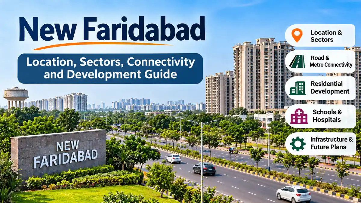
New Faridabad is one of the most rapidly developing parts of Faridabad, Haryana. Located within the National Capital Region (NCR), it has attracted attention because of its planned residential sectors, expanding road network, high-rise housing projects, and proximity to Delhi.
However, understanding New Faridabad requires more than looking at apartment buildings or property advertisements. The area includes several developing neighbourhoods, and infrastructure quality can vary considerably between sectors.
New Faridabad generally refers to the newer residential and urban development areas of Faridabad, particularly the Greater Faridabad region, commonly known as Neharpar. It includes planned sectors such as 75–89, where residential societies, commercial developments, schools, and public infrastructure have expanded over time. The area is part of Haryana’s wider NCR urban development landscape.
This guide explains where New Faridabad is located, how its sectors are organised, its transportation connections, available facilities, and the challenges associated with its continuing development.
Where Is new faridabad Located?
New Faridabad is situated in the eastern part of Faridabad district in Haryana, India. It forms part of the Delhi NCR, a large metropolitan region encompassing Delhi and surrounding urban centres.
The name is commonly associated with Greater Faridabad, also called Neharpar because of its location beyond the Agra Canal relative to older parts of the city.
Faridabad itself lies southeast of Delhi and is an important industrial and residential centre within the NCR.
New Faridabad vs Old Faridabad
Although the two areas belong to the same city, their urban characteristics differ.
| Feature | New Faridabad | Old Faridabad |
|---|---|---|
| Development | Newer planned sectors and housing projects | Established residential and commercial neighbourhoods |
| Housing | High-rise apartments, group housing and plotted areas | Independent houses, older apartments and mixed housing |
| Roads | Wider planned sector roads in many locations | Older roads and established traffic corridors |
| Commercial facilities | Developing markets and commercial centres | Established markets and business districts |
| Public transport | More dependent on road connections | Better access to existing metro and railway facilities in many areas |
| Infrastructure | Uneven completion across sectors | More mature but sometimes congested infrastructure |
New Faridabad’s planned layout is a major distinction, but newer development does not necessarily mean every neighbourhood has better civic services.
Major Sectors in New Faridabad
Greater Faridabad is commonly associated with sectors 75 to 89, although descriptions of the wider New Faridabad area sometimes include neighbouring sectors and developments.
These sectors contain a mixture of group housing societies, residential plots, commercial sites, institutional land and public facilities.
Sectors 75–79
This cluster includes several planned residential developments and apartment communities.
Sector 75 and neighbouring areas are associated with group housing projects, local shopping facilities and road links connecting Greater Faridabad with the established city.
Development levels differ between individual societies, particularly regarding internal roads, drainage, landscaping and access to commercial facilities.
Sectors 80–84
These sectors form another significant residential belt.
Sector 81 is frequently mentioned in discussions of Greater Faridabad because of its residential developments and connections to surrounding commercial and institutional facilities.
Sectors 82, 83 and 84 also contain residential projects and planned urban infrastructure.
The condition of individual housing societies and surrounding roads should be assessed separately rather than assuming that facilities are identical across the cluster.
Sectors 85–89
The eastern and southeastern portions of the planned residential belt include sectors such as 85, 86, 87, 88 and 89.
These areas feature apartment complexes, residential plots and developing neighbourhood services.
Some locations have established communities, while others still experience construction activity and incomplete supporting infrastructure.
Understanding the Sector Layout
Sector numbers are useful for identifying broad locations, but they do not always indicate how close two destinations are in actual travel time.
Canals, road intersections, unfinished connections and traffic conditions can affect accessibility.
For accurate navigation, it is better to check a specific society, landmark or street rather than relying only on the sector number.
Connectivity and Transportation in new faridabad
Connectivity is one of the most important factors shaping everyday life in New Faridabad.
The area benefits from access to established Faridabad roads, Delhi-bound corridors and newer expressway infrastructure. However, public transportation remains less convenient in several residential sectors than in the older parts of the city.
Road Connectivity
Major road connections include:
- Faridabad Bypass Road: An important north–south corridor linking different parts of the city and connecting with expressway infrastructure.
- Mathura Road (NH-44): A major route connecting Faridabad with Delhi and other destinations in Haryana.
- Delhi–Mumbai Expressway connectivity: The DND–Sohna corridor improves regional road access through the Faridabad area.
- Faridabad–Noida routes: Road connections towards Noida are available, although the most convenient route depends on the destination and current traffic conditions.
- Faridabad–Gurugram Road: Provides a connection towards Gurugram through the Aravalli region.
The DND–Sohna expressway corridor is particularly significant because it provides an alternative to some older city routes. Nevertheless, access from individual residential sectors can still involve busy intersections and canal crossings. Haryana.com+1
Metro Connectivity in New Faridabad
The Delhi Metro Violet Line serves Faridabad, connecting the city with Delhi.
Important stations include Old Faridabad, Neelam Chowk Ajronda, Bata Chowk, Escorts Mujesar and Raja Nahar Singh (Ballabhgarh).
As of November 2026, there is no operational Delhi Metro station within the main Neharpar residential sectors.
Residents generally reach an existing Violet Line station by car, autorickshaw or another road-based transport service.
Metro expansion proposals involving Greater Faridabad have been studied, but a feasibility study is not equivalent to an approved and operational service. ADiHomes+1
For daily commuters, the practical journey includes the time needed to reach the metro station, the metro journey itself and the final connection to their destination.
Connectivity to Delhi, Noida and Gurugram
New Faridabad is geographically connected to several important NCR employment centres.
| Destination | Main Connectivity Consideration |
|---|---|
| South Delhi | Road connections and Violet Line access |
| Central Delhi | Violet Line through Faridabad |
| Noida | Road routes via Delhi or other available crossings |
| Greater Noida | Road connections dependent on available bridges and approach roads |
| Gurugram | Faridabad–Gurugram Road and regional expressway routes |
| Ballabhgarh | Faridabad’s internal roads and metro corridor |
Actual travel times vary with the sector, destination, traffic and mode of transport.
Someone travelling regularly to Delhi should evaluate the full door-to-door commute rather than relying on a general estimate for Faridabad.
Residential Development and Housing in New Faridabad
Residential construction has been a major driver of Greater Faridabad’s growth.
The area contains a combination of high-rise apartments, independent floors, plotted residential developments and gated housing societies.
High-Rise Apartment Communities
Apartment complexes are among the most recognisable features of New Faridabad.
Developments associated with names such as BPTP Parklands, Omaxe Heights and RPS Savana have contributed to the area’s residential landscape. Haryana.com+1
Facilities in apartment societies may include security arrangements, parking, lifts, landscaped areas, community halls and recreational spaces.
However, these amenities are project-specific. Their existence and maintenance standards cannot be assumed from promotional descriptions alone.
Independent Floors and Residential Plots
Some sectors also contain builder floors and plotted residential neighbourhoods.
These housing types offer different living arrangements from high-rise apartments, particularly regarding building density, shared facilities and maintenance responsibilities.
The surrounding infrastructure can be just as important as the property itself.
For example, a residential building may be complete while nearby footpaths, street lighting or drainage systems remain under development.
Why Residential Conditions Vary
New Faridabad did not develop as one single construction project.
Different developers completed projects at different times, while public infrastructure was implemented through separate planning and administrative processes.
Consequently, two housing societies in the same sector can have different experiences with water supply, access roads, maintenance and nearby services.
Schools, Hospitals and Everyday Facilities
New Faridabad has become a more established residential area as educational institutions, healthcare facilities and local businesses have expanded.
Nevertheless, access to essential services differs across its neighbourhoods.
Schools and Educational Institutions
Families living in Greater Faridabad can find private schools and other educational institutions within the wider Faridabad region.
When assessing school accessibility, useful considerations include the school’s actual distance from home, transportation arrangements, traffic conditions and available facilities.
A school located in an adjacent sector may still require a relatively long journey if direct road connections are limited.
Hospitals and Healthcare
Modi unveils Asia’s largest pvt hospital in Faridabad
Amrita Hospital, Faridabad
Amrita Hospital in Sector 88 is a major healthcare institution serving Greater Faridabad and the surrounding NCR region.
Its presence is an important addition to the area’s medical infrastructure.
Residents also have access to other hospitals, clinics, diagnostic centres and pharmacies across Faridabad.
For emergency healthcare, the relevant consideration is the actual travel time to an appropriate facility rather than simply the number of hospitals listed in the wider district.
Shopping and Local Markets
Daily shopping facilities in New Faridabad include neighbourhood stores, pharmacies, grocery shops and developing commercial areas.
Some residential societies have nearby convenience stores or commercial spaces.
Larger shopping and entertainment destinations may require travelling to more established parts of Faridabad.
Commercial development continues to evolve as residential occupancy increases.
Parks and Recreational Facilities
Planned green spaces, community parks and landscaped areas are part of the broader residential development concept.
Some housing societies provide internal recreational facilities, while other neighbourhoods depend on public parks and sector-level open spaces.
The availability, accessibility and maintenance of these facilities vary considerably.
Infrastructure and the Faridabad Master Plan 2031
The Faridabad Development Plan 2031 provides the broader planning framework for urban expansion, including residential, industrial, commercial, transport and public infrastructure uses.
The Haryana government’s final development plan was published through a notification dated March 14, 2018. Green Tribunal+1
What Does the Master Plan Cover?
The planning framework addresses several major aspects of urban growth:
- Allocation of land for residential, industrial and commercial development.
- Reservation of corridors for major roads and transportation infrastructure.
- Provision for public and institutional facilities.
- Identification of green belts and other land-use restrictions.
- Expansion of urban infrastructure to support future population growth.
The plan also includes proposed development areas beyond the established Greater Faridabad residential sectors.
However, a planned land use does not establish that construction has started or that infrastructure is already available.
Water Supply and Drainage
Water supply and drainage are important challenges in parts of Greater Faridabad.
Some neighbourhoods have experienced dependence on groundwater or water tankers, while waterlogging has been reported in locations where drainage systems are inadequate. Haryana.com
Conditions vary between societies and sectors.
When evaluating a neighbourhood, residents should distinguish between permanent water supply infrastructure, temporary arrangements and services provided by individual housing associations.
Roads and Street Lighting
Major roads may be wider and better developed than some internal residential streets.
Incomplete service roads, damaged surfaces, inadequate pedestrian infrastructure and inconsistent street lighting can still affect local accessibility.
The condition of an approach road is especially relevant because residents may use it multiple times each day.
Future Transportation Projects
Proposed regional infrastructure includes the Faridabad–Noida–Ghaziabad Expressway, the Faridabad–Jewar airport road connection and rapid-transit proposals.
A Gurugram–Faridabad Namo Bharat corridor has also been discussed, with proposed Greater Faridabad stops in the Sector 80–89 belt. 1acre.in+1
These projects are at different stages of planning, approval or construction. Their proposed routes and completion schedules should not be treated as confirmed operational infrastructure.
Advantages and Challenges of Living in new faridabad
New Faridabad offers several characteristics that distinguish it from older NCR neighbourhoods, but it also has practical limitations.
| Potential Advantages | Important Challenges |
|---|---|
| Planned residential sector layouts | Uneven completion of infrastructure |
| Wide arterial roads in many areas | Traffic at canal crossings |
| Range of apartment and plotted housing | No operational metro within the main Neharpar sectors |
| Access to regional road corridors | Dependence on private vehicles in some locations |
| Growing educational and healthcare facilities | Water supply and drainage concerns in certain areas |
| Developing commercial neighbourhoods | Different maintenance standards between societies |
What Makes New Faridabad Attractive to Residents?
One of the area’s main advantages is the availability of relatively modern residential developments within the Delhi NCR.
Many housing projects offer apartment layouts and community facilities that differ from older, densely developed neighbourhoods.
The presence of planned sector roads and developing institutional infrastructure also contributes to its appeal.
What Are the Main Everyday Challenges?
Transportation remains an important consideration, particularly for residents who depend entirely on public transport.
A household with workplaces or schools located far from its residential sector may face substantial daily travel.
Other challenges include inconsistent civic services, ongoing construction and differences in neighbourhood maintenance.
These issues should be assessed at the society and street level rather than attributed equally to every part of New Faridabad.
How to Evaluate a Neighbourhood in New Faridabad
Understanding an individual sector requires looking beyond its location on a map.
A practical neighbourhood assessment can be organised around five factors.
- Transportation: Check the routes to workplaces, schools and metro stations during normal commuting hours.
- Essential services: Identify nearby hospitals, grocery stores, pharmacies and other everyday facilities.
- Infrastructure: Examine road surfaces, drainage, street lighting and water supply arrangements.
- Residential environment: Consider noise, construction activity, green spaces and building maintenance.
- Planning and documentation: Verify applicable land use, development permissions and project documentation through the relevant authorities.
For property-related information, Haryana’s Real Estate Regulatory Authority and the Department of Town and Country Planning provide important official reference points.
The Haryana Shahari Vikas Pradhikaran (HSVP), Faridabad Metropolitan Development Authority (FMDA) and Municipal Corporation of Faridabad also have responsibilities relating to different aspects of urban development and public infrastructure.
Responsibilities can overlap or change as infrastructure is transferred between agencies.
Why Visiting at Different Times Matters
A neighbourhood can feel very different during a weekday morning, an evening commute and a rainy afternoon.
Morning visits reveal school and workplace traffic, while evening visits help assess street lighting and access to essential shops.
Rainy-weather observations can reveal drainage problems that may not be apparent during dry conditions.
These simple checks provide a more realistic understanding of local living conditions than photographs or broad sector descriptions alone.
The Future of New Faridabad
The long-term development of New Faridabad is closely linked to the wider growth of the National Capital Region.
Its established residential sectors provide a foundation for additional commercial, educational, healthcare and transport infrastructure.
However, future development depends on several factors, including infrastructure funding, project implementation, civic maintenance and regional transportation planning.
Expansion Beyond the Established Sectors
The Faridabad Master Plan 2031 includes additional planned development areas beyond the original Neharpar residential belt.
Some newer sectors remain at an early stage of development, and land designated for future urban use may not yet have completed roads, utilities or public services. 1acre.in
It is therefore necessary to distinguish established residential neighbourhoods from areas that exist primarily in planning documents.
The Role of Regional Connectivity
Improved road and public transportation connections could make Greater Faridabad more accessible to other NCR employment centres.
At the same time, the benefits of major regional projects depend on local access roads, junction design and the availability of convenient last-mile transportation.
A nearby expressway does not automatically eliminate congestion on internal roads.
What Will Shape the Area’s Development?
The most meaningful improvements for existing residents are likely to involve reliable water supply, effective drainage, maintained roads, better public transportation and accessible community facilities.
These improvements affect everyday living conditions regardless of how quickly new buildings are constructed.
Final Thoughts on new faridabad
New Faridabad, particularly the Greater Faridabad or Neharpar region, represents an important part of Faridabad’s urban expansion.
Its residential sectors, planned road networks, developing facilities and connections to the wider NCR have transformed previously less-developed areas into established neighbourhoods.
At the same time, differences in infrastructure, public transportation and civic services remain important.
The most useful way to understand New Faridabad is to examine its individual sectors, verify the facilities already operating and distinguish completed infrastructure from future proposals.
For residents, visitors and anyone researching the area, this sector-by-sector approach provides a clearer picture of how New Faridabad functions today and how it may continue to develop.